Submitted by Dr C.M. Martin-Jones on Thu, 29/10/2020 - 11:57
Specially-adapted drones, developed by an international team involving scientists from the University of Cambridge, are transforming how we forecast eruptions by allowing close-range measurements of previously inaccessible and hazardous volcanoes.
The team, involving twenty researchers from seven countries, used long-range drones kitted out with a range of lightweight sensors to study the Manam volcano - one of the most active volcanoes in Papua New Guinea.
Their findings, published today in Science Advances, show how combined measurements from the air, earth and space can be used to understand volcanic contributions to the global carbon cycle, key to sustaining life on Earth.
One of the best ways to detect signs of an impending eruption is to 'breathalyse' a volcano by taking regular measurements of volcanic gases. Any change in the ratio of sulfur and carbon dioxide released can warn of an impending eruption. But sampling remote or hazardous volcanoes like Manam is more challenging.
When the volcano last erupted between 2004 and 2006 the entire island was evacuated - crops were destroyed and water supplies contaminated. The islanders only started to return five years ago.
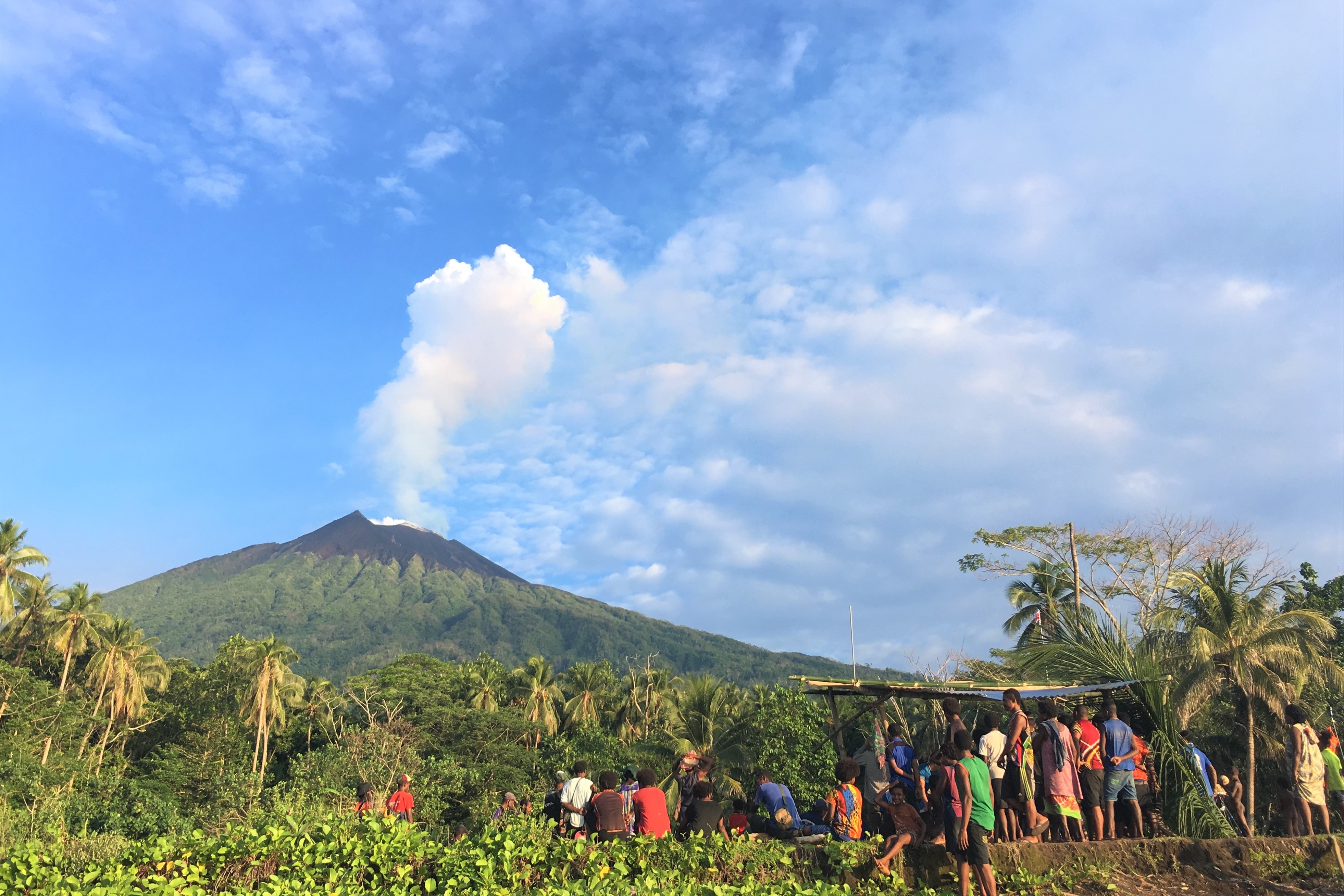
The local community on Manam Island lives in the shadow of the volcano. View from Baliau village, Manam. Image credit Emma Liu.
Previous studies have shown that Manam is one of the world’s biggest emitters of sulphur dioxide, but nothing was known of its CO2 output.
Measuring volcanic CO2 emissions is more challenging because it is already present in high concentrations in the atmosphere. The only way to get accurate readings is to take samples close to active vents.
Collecting samples on Manam would be incredibly risky; not only is the vent flanked by precarious slopes, the volcano is also unmonitored so there would be little warning if an eruption struck.
Using drones equipped with miniaturised gas sensors, spectrometers and sampling devices, the team piloted flights directly into the plume emerging from Manam’s vent. The measurements captured gas composition, temperature and humidity in real-time.
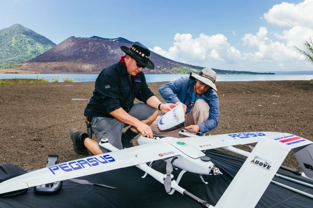
Preparing for a test flight with the Pegasus vertical-takeoff-and-land (VTOL) drone. Featuring Dr Jorge Andres Diaz, and Alfredo Alan (University of Costa Rica). Image credit Matthew Wordell.
The project - Aerial-Based Observations of Volcanic Emissions (ABOVE) – saw the first global collaboration between scientists, remote-sensing specialists, engineers and pilots.
Project lead Dr Emma Liu, previously a research fellow in the Department of Earth Sciences, University of Cambridge, and now at University College London, said "these aerial measurements are pushing the frontiers of the current state-of-the art in volcano monitoring".
"From the existing satellite data we know that Manam is a significant source of volcanic emissions, but that data came with a lot of uncertainty because it was measured at a distance”.
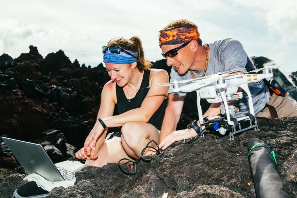
Taking a look at the new data soon as the drone returns. Featuring Dr Emma Liu (UCL) and Dr Kieran Wood (University of Bristol), using an Airgraph Aeris gas sensor mounted on a DJI Phantom 3 Pro quadcopter. Image credit Matthew Wordell.
"The resources of the in-country volcano monitoring institute are small and the team has an incredible workload, but they really helped us make links with the community living on Manam island” said Liu.
Following the fieldwork, the researchers raised funds to buy computers, solar panels and other technology to enable the local community – who have since put together a disaster preparedness group - to communicate via satellite from the island, and to provide drone operations training to Rabaul Volcanological Observatory staff to assist in their monitoring efforts.
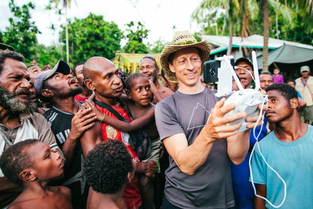
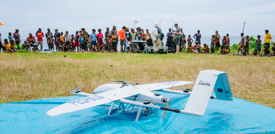
Demonstrating some of the drone flight controls to an interested crowd from the local community. Featuring Dr Scott Nowicki (University of New Mexico). Image credit Matthew Wordell.

Community engagement is a large part of the project - teaching and learning from children in the local school about the volcanic hazards they face. Featuring Jim Freer (University of Bristol and University of Saskatchewan). Image credit Matthew Wordell.
ABOVE was part of the Deep Carbon Observatory (DCO), a global community of scientists on a ten-year quest to understand more about carbon in Earth.
"Volcanic emissions are a critical part of the Earth’s carbon cycle - the movement of carbon between land, atmosphere, and ocean – but CO2 measurements have so far been limited to a relatively small number of the world’s estimated 500 degassing volcanoes" explains co-author Professor Marie Edmonds, who is based in the Department of Earth Sciences at Cambridge.
"Aerial gas measurements, collected along transects through the plume, together with ground-based and satellite data show that Manam is a major volcanic emission source on a global scale, and our calculation rank it 5th in terms of its carbon flux".
Co-author Professor Alessandro Aiuppa (University of Palermo) described the findings as 'a real advance in our field', adding: "Ten years ago you could have only stared and guessed what Manam’s CO2 emissions were".
"If you take into account all the carbon released by global volcanism, it’s less than a per cent of the total emission budget, which is dominated by human activity. In a few centuries, humans are acting like thousands of volcanoes. If we continue to pump carbon into the atmosphere, it will make monitoring and forecasting eruptions using aerial gas observations even harder."
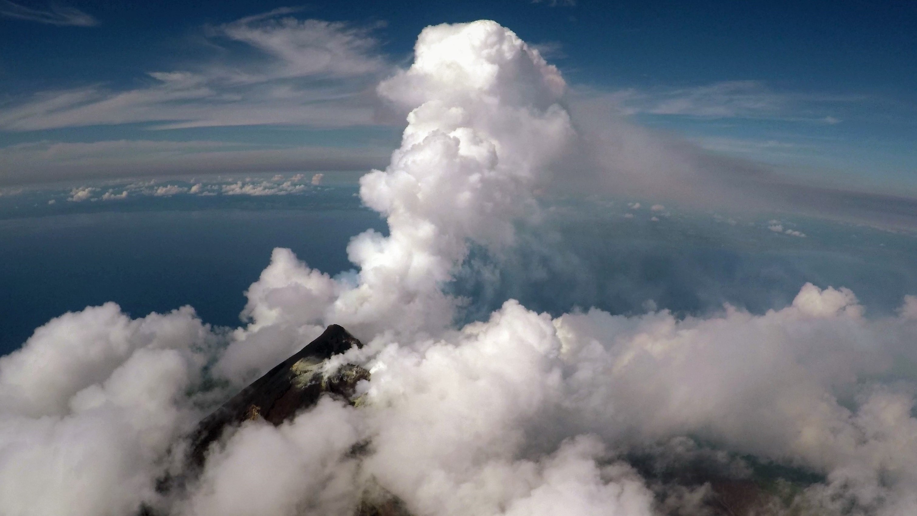
Aerial view of the active vent and gas plume of Manam volcano, Papua New Guinea, from a fixed-wing drone at 2300 m altitude. Image credit Emma Liu.
Co-author Professor Tobias Fischer (University of New Mexico), added: "In order to understand the drivers of climate change you need to understand the carbon cycle in the Earth".
"We wanted to quantify the carbon emission from this very large carbon dioxide emitter. We had very little data in terms of carbon isotope composition, which would identify the source of the carbon - whether it is from the mantle, crust or sediment. We wanted to know where that carbon comes from".
"Drones are changing not only the way we monitor volcanoes – they also help us to understand what causes eruptions, and how carbon moves between the Earth’s interior and atmosphere" explains Edmonds.
"If we know how volcanic emissions interacted with the climate in the past, we are closer to understanding controls on our present-day climate and how it may respond to future human-driven impacts".
ABOVE was funded by Alfred P. Solan Foundation
E.J. Liu et al. ‘Aerial strategies advance volcanic gas measurements at inaccessible, strongly degassing volcanoes.’ Science Advances (2020). DOI: 10.1126/sciadv.abb9103.
Adapted from a press release by UCL.
